
TAKE A WALK ON MARS
25 AUGUST 2022
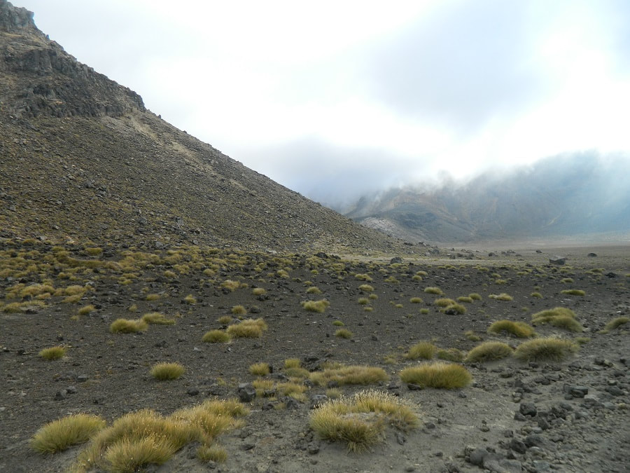
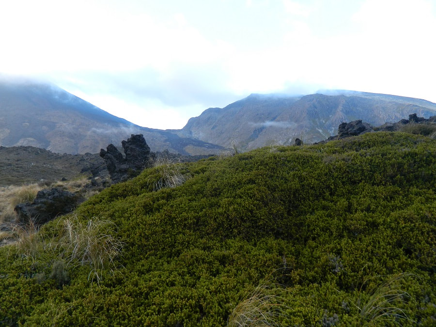
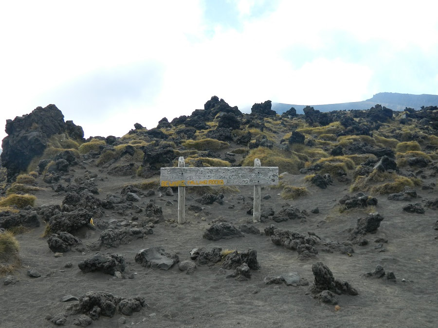
There was very little animal life on the crossing
The Crossing
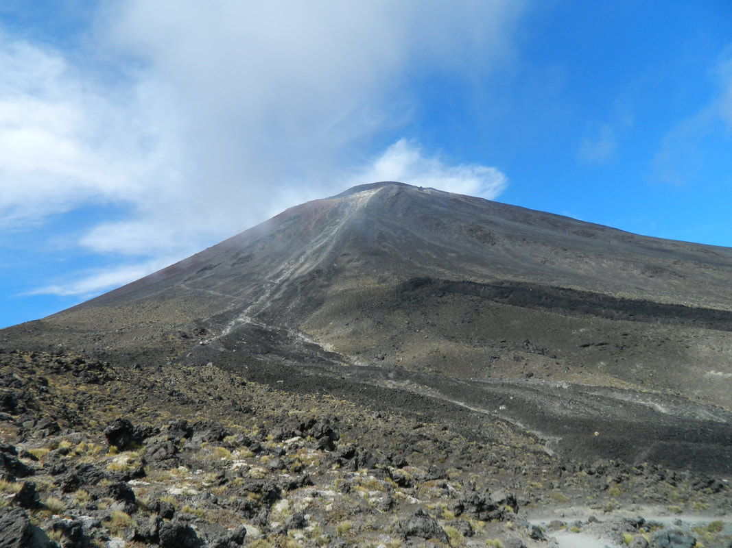
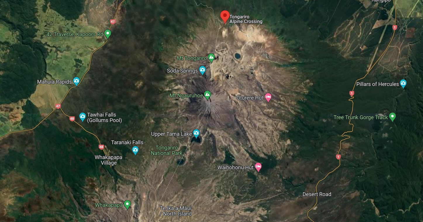
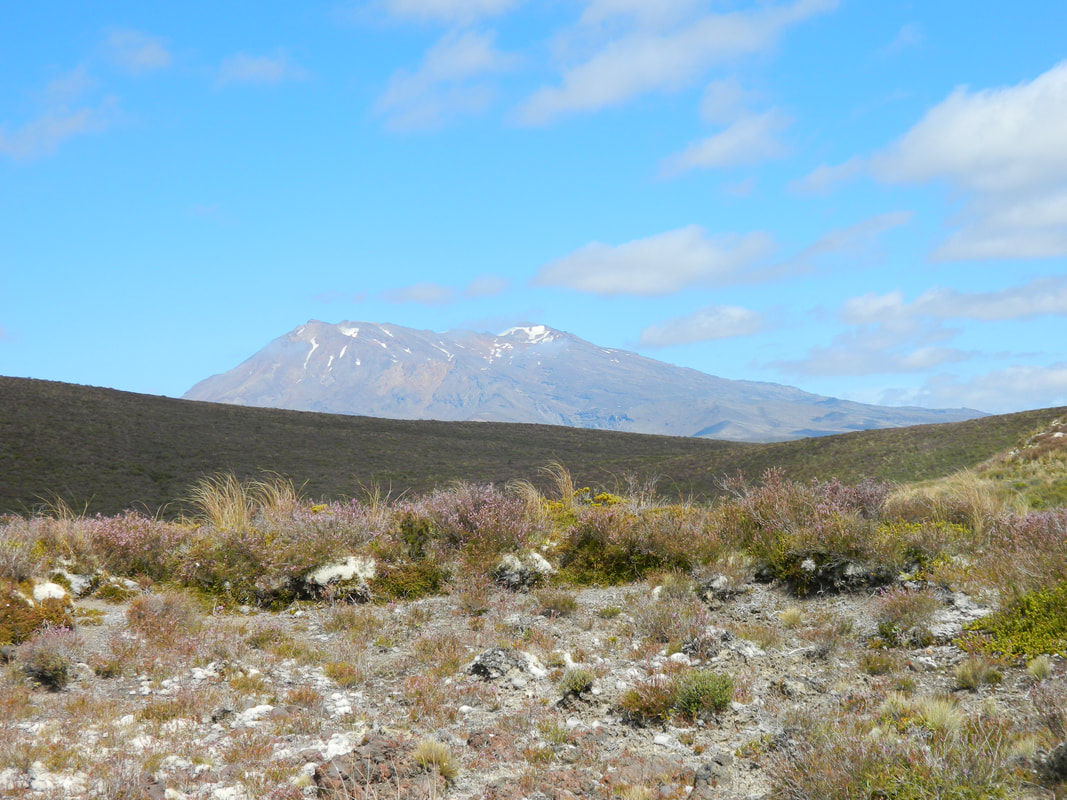
The Tongariro Alpine Crossing is a 19.4km hike takes you through volcanic landscape like glacial valleys and crater lakes which showcase incredible views of Mt Ngarahoe (Mt Doom in LOTR!) and the dormant giant - Mt Ruapehu. It's located in central North Island, in the Tongariro National Park which is a World Heritage Site.
The crossing is considered to be one of the best day hikes in New Zealand and we can see why! Your hard work and perseverance are paid off with incredible sweeping views of the region including the blue and emerald lakes, while hiking through volcanic terrain.
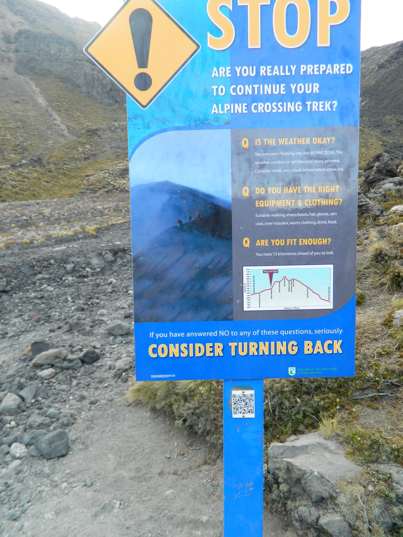
It has its challenges - it's a 7-9 hour hike, you need to climb around 2 hours of stairs on the Devil's Staircase (aptly named), there are some hills with scree and of course there's always the chance of volcanic activity.... but what's exploring without its risks?
This is a hike we did in 2012 before we had our girls and we hope to complete it one day soon with them!
The crossing is considered to be one of the best day hikes in New Zealand and we can see why! Your hard work and perseverance are paid off with incredible sweeping views of the region including the blue and emerald lakes, while hiking through volcanic terrain.
It has its challenges - it's a 7-9 hour hike, you need to climb around 2 hours of stairs on the Devil's Staircase (aptly named), there are some hills with scree and of course there's always the chance of volcanic activity.... but what's exploring without its risks?
This is a hike we did in 2012 before we had our girls and we hope to complete it one day soon with them!
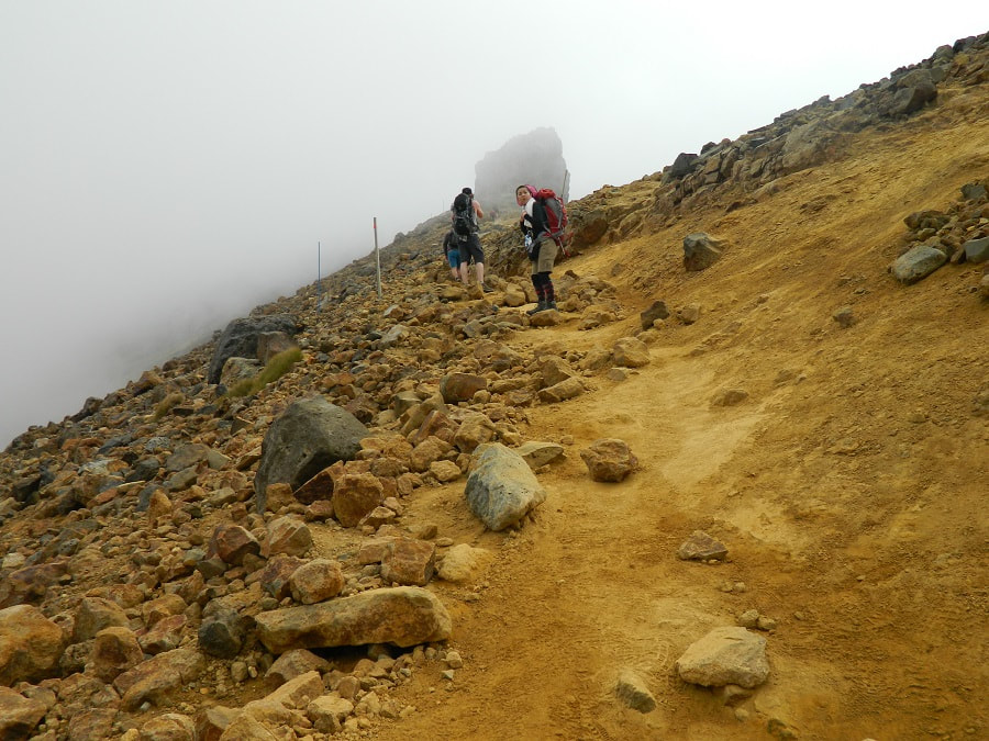
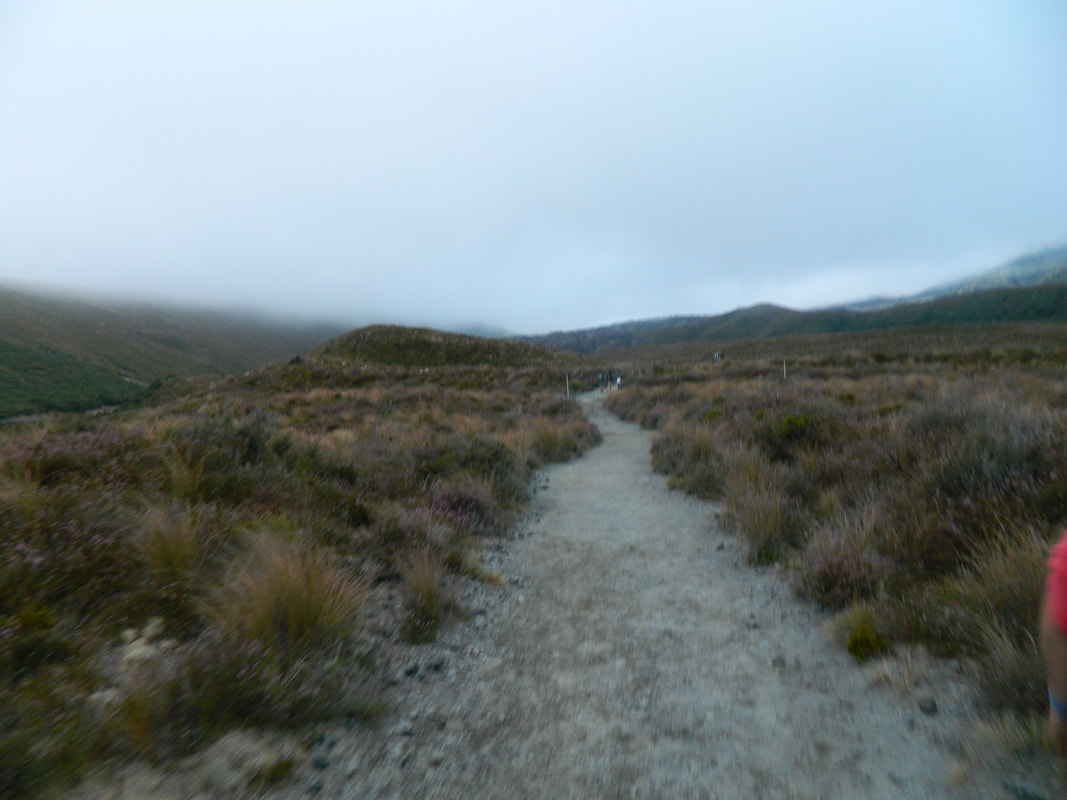
The walk starts off easy - don't be fooled!
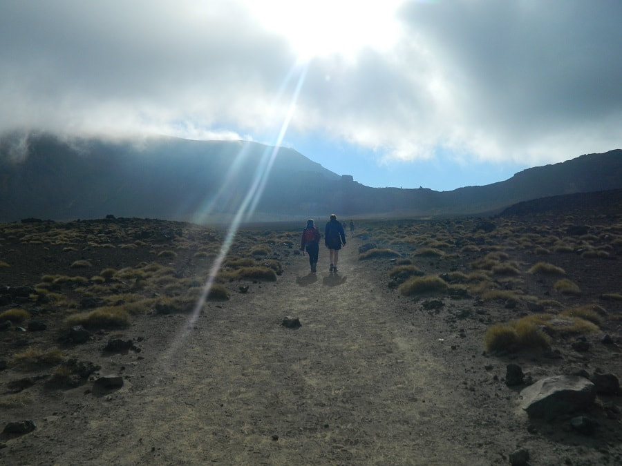
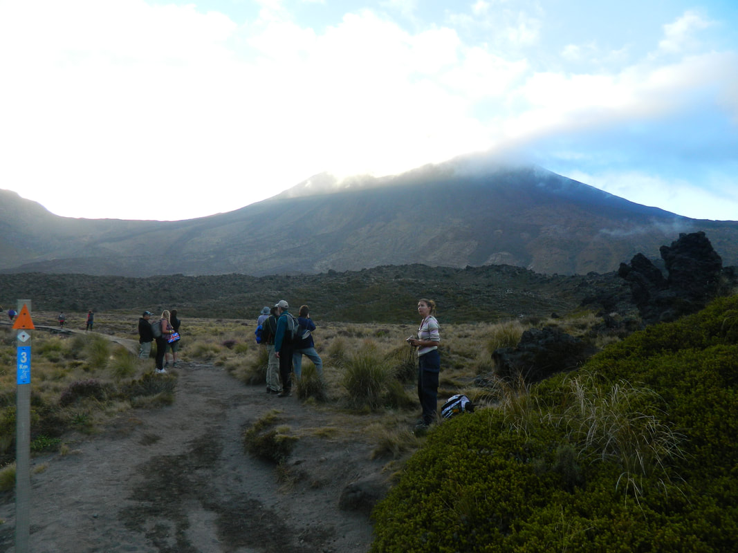
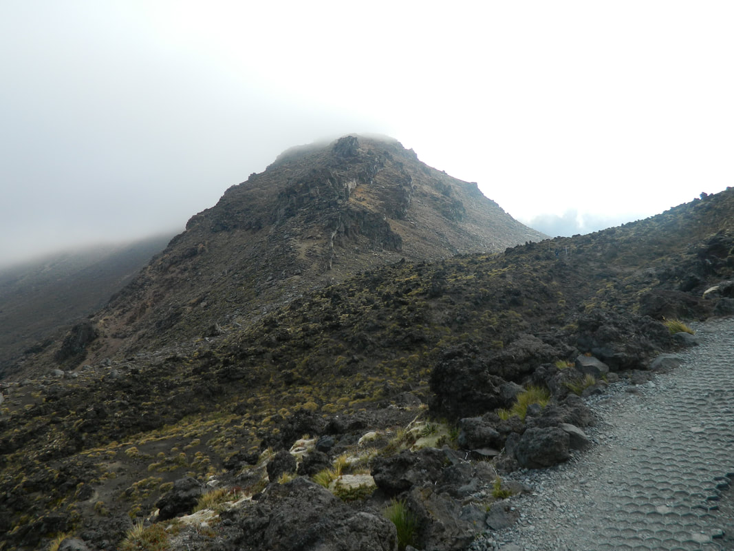
The sun breaking through the clouds made a great photo
|
The Blue Lake is sacred to the Maori so you cannot touch the lake or even eat/drink near it. |
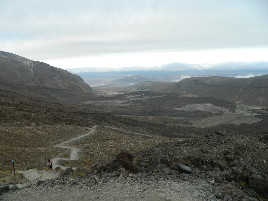
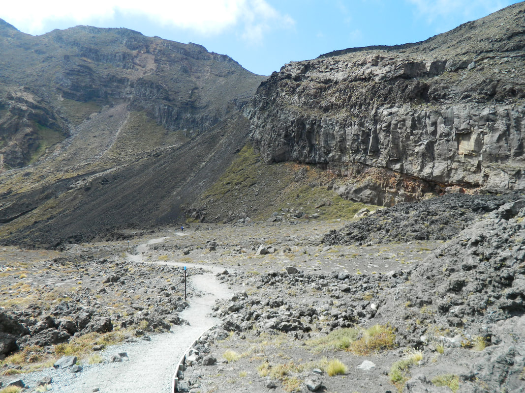
Looking back, we could see how far we had come
We Just Need To Vent About Something
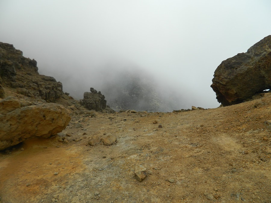
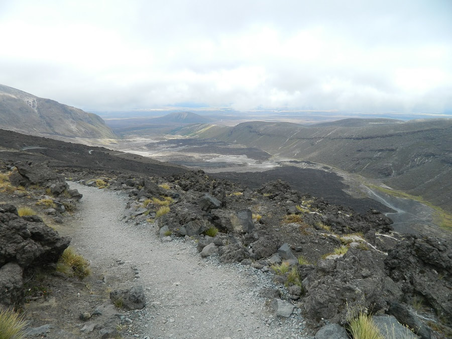
When we did the hike in 2012, we were unable to do the 19.4kms from start to finish due to the Te Maari Crater which had erupted and there was a 1km hazard zone in place, which meant we could go to the Emerald Lakes then we had to turn back.
We actually weren't disappointed at all, as the hike was out of this world! On the way up it was pretty cloudy and on the way back down, the clouds started to clear so we got a totally different aspect on the views both directions.
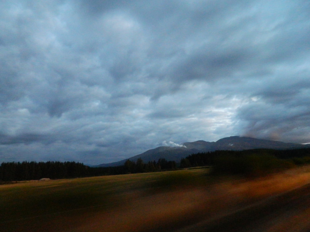
We had great views of the steam vent as we were driving to our accommodation for the night, even though it was getting pretty dark, but you could clearly see the white steam plummeting out of Tongariro.
We actually weren't disappointed at all, as the hike was out of this world! On the way up it was pretty cloudy and on the way back down, the clouds started to clear so we got a totally different aspect on the views both directions.
We had great views of the steam vent as we were driving to our accommodation for the night, even though it was getting pretty dark, but you could clearly see the white steam plummeting out of Tongariro.
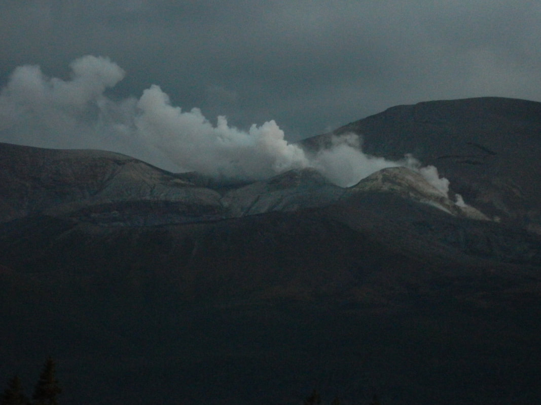
The steam vent - yes, yes, bad photo - 2012 kinda camera zoom in quality!

The steam vent prevented us from doing the whole track
It Was Like Being On Mars
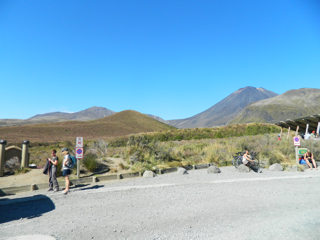
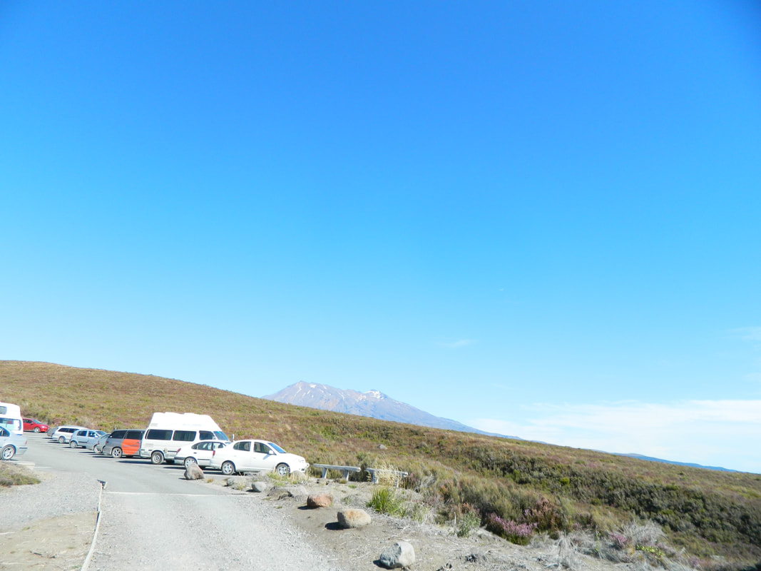
We took a shuttle from our accommodation to the start of the track because of the 4-hour max parking in the month we were there and we had heard there were a lot of break ins at this carpark (knowing people will be gone for a long time but this may have changed now) so the best option for us was to get the shuttle.
We left at 6am which was hard to wake up to, get on a bus and start a 7-hour hike! However, this is necessary because of the daylight hours - you don't want to be walking back in the dark.
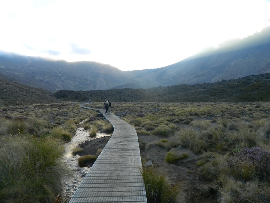
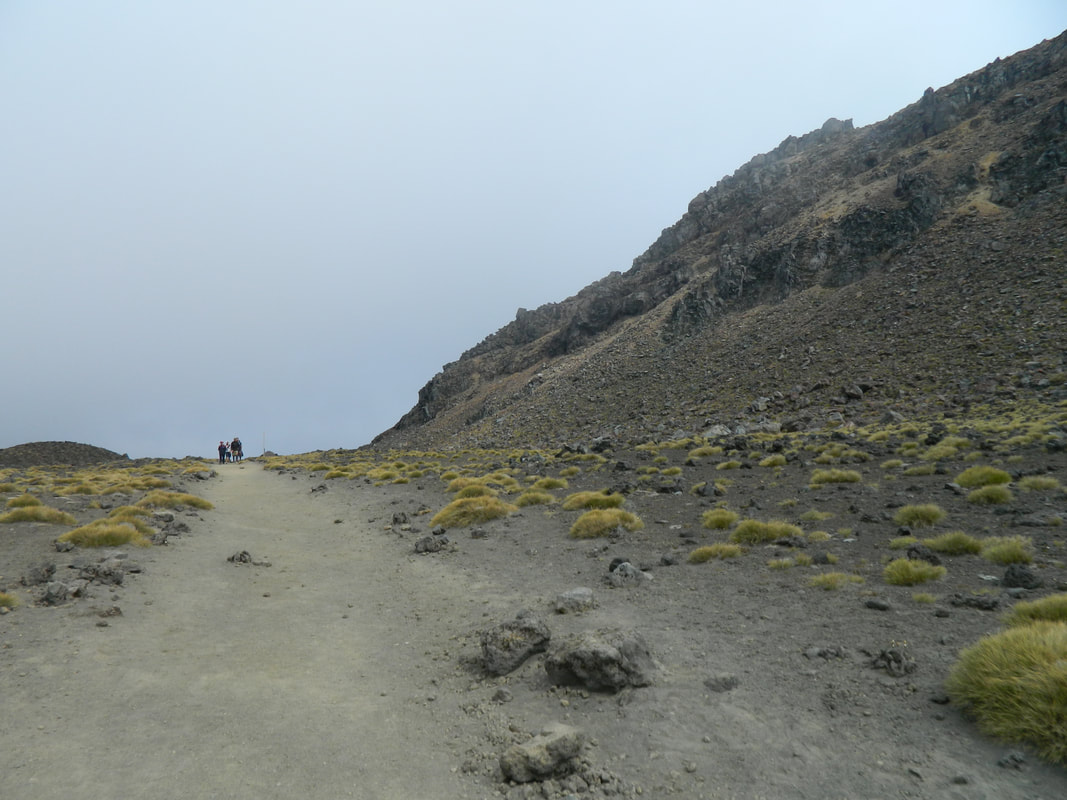
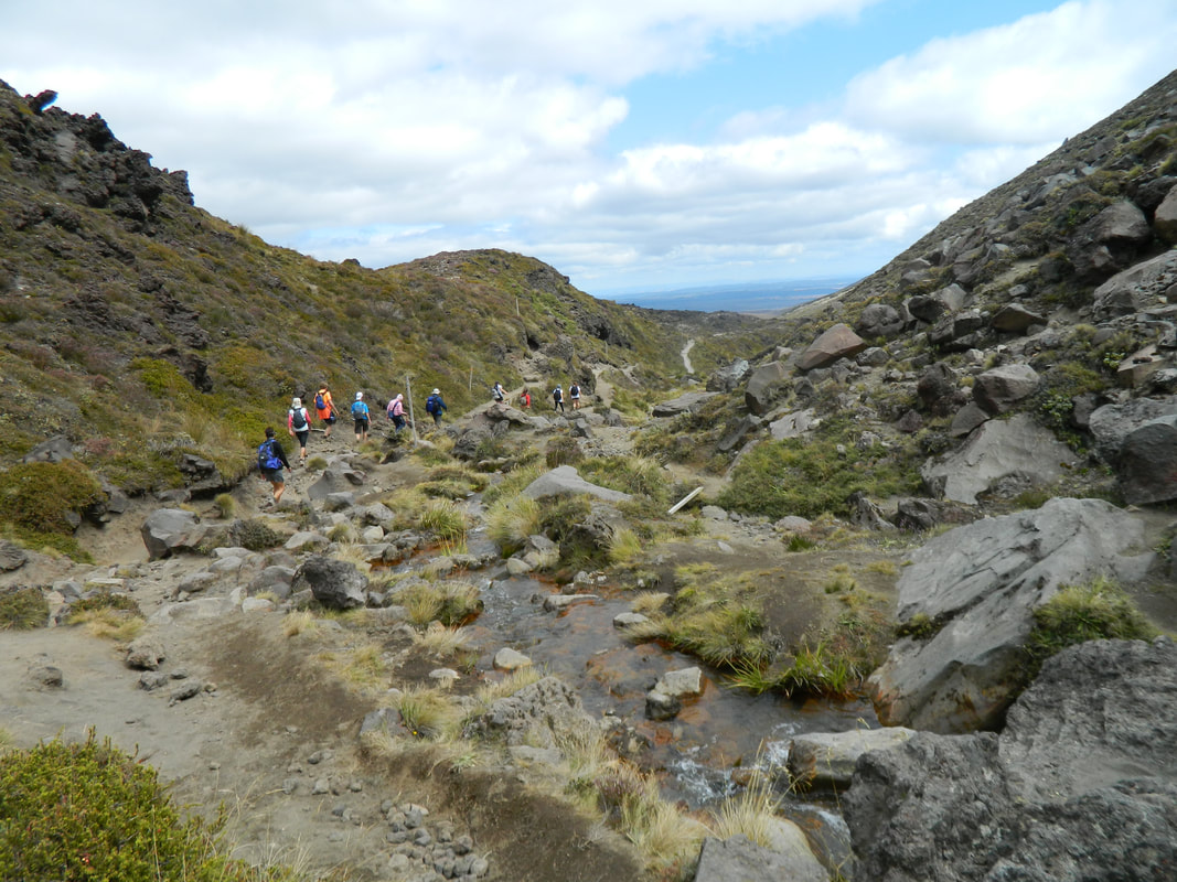
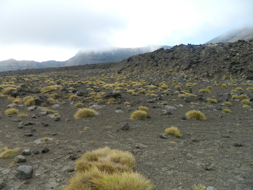
The first part of the track is a flat boardwalk that takes you through a valley, tricking you into thinking the whole walk is like this! Cheeky! You are dwarfed by mountains as you make your way along beside the Mangatepepo Stream and flat areas with rocks and grasses. If the weather is bad in the valley, it's advised to turn back as the weather will get worse the higher up the mountain you go.
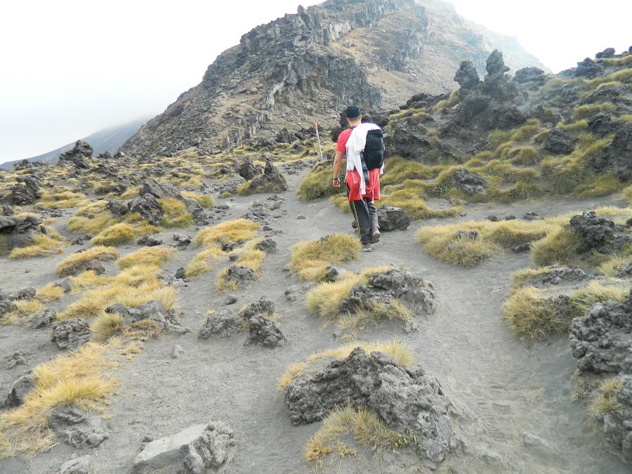
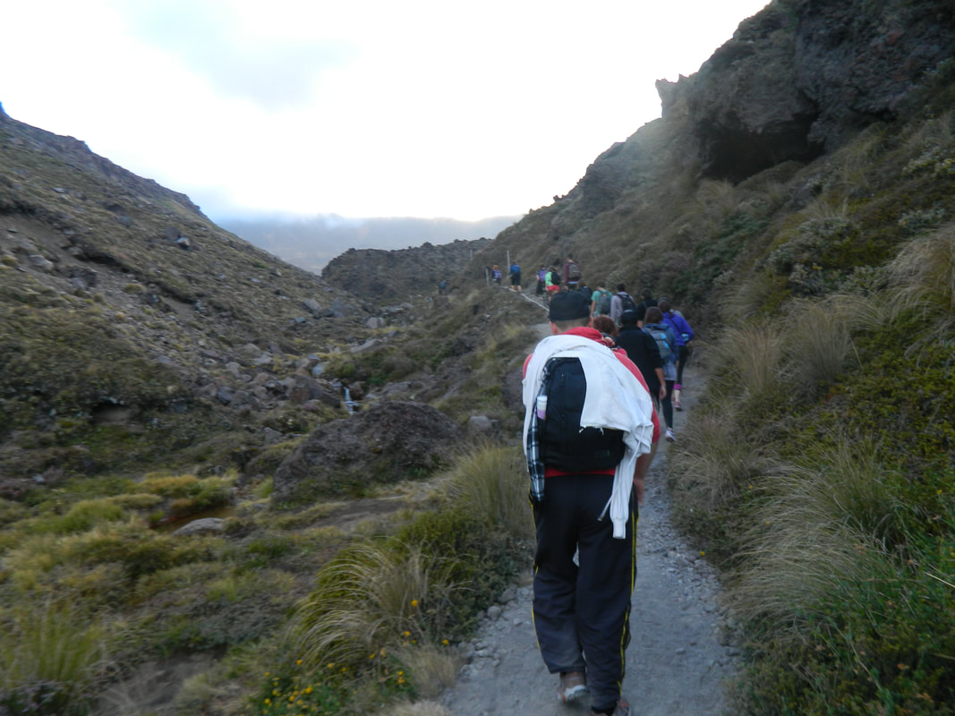
When the flat part of the track ends, you know you've made it to the Devil's Staircase - 2 hours of thigh-burning, ankle-killing stairs! With every step, you just have to think about how amazingly toned your calves and thighs will be afterwards. The staircase takes you up over 1400 meters above sea level and offers some pretty sweet views of the valley below. Once the stairs stop, you still trek upwards, through ancient lava flows and around big boulders.
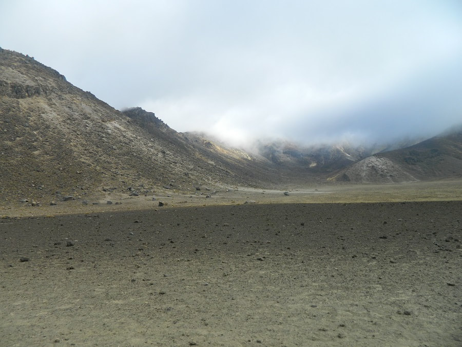
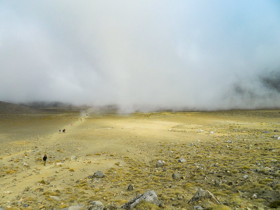
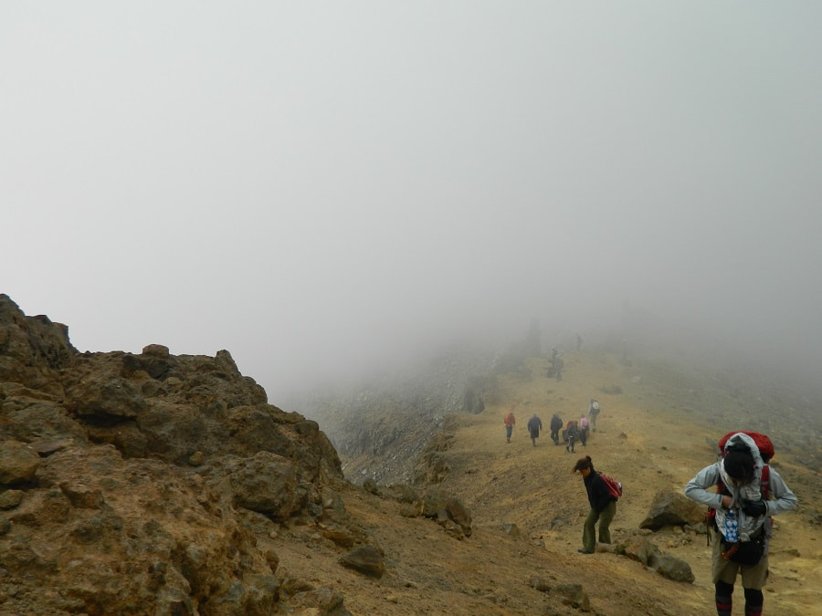
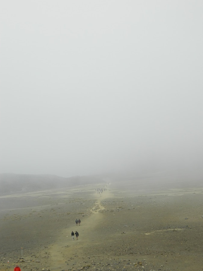
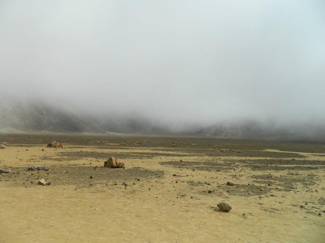
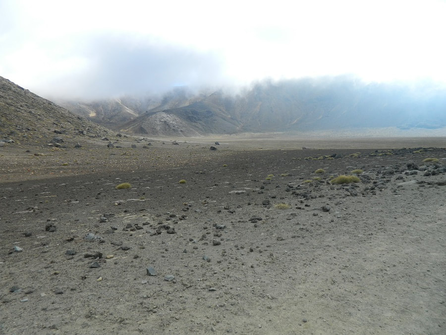
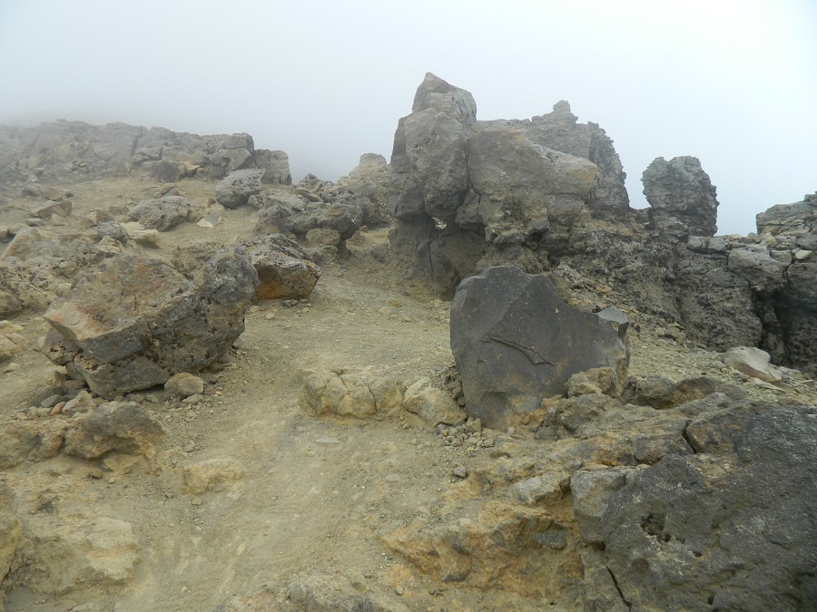
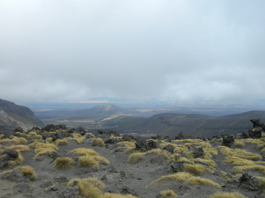
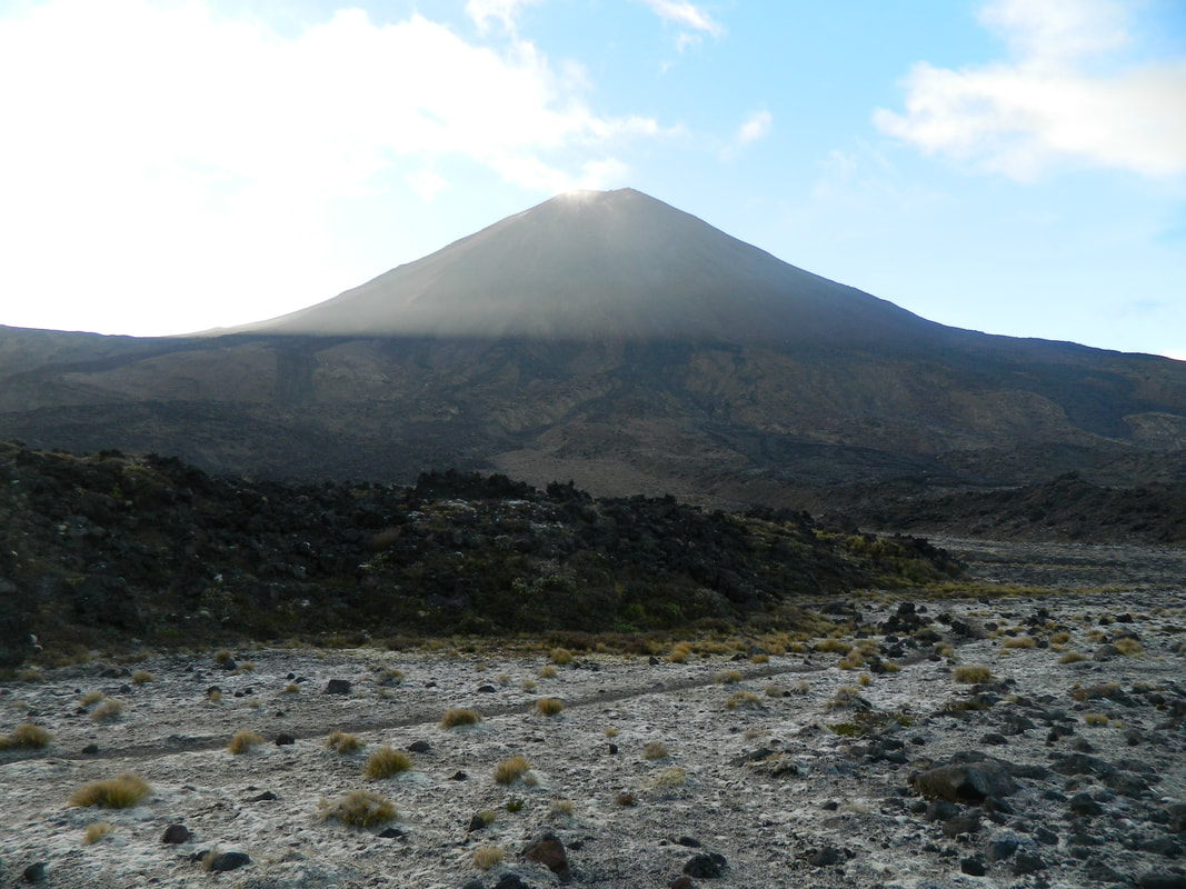
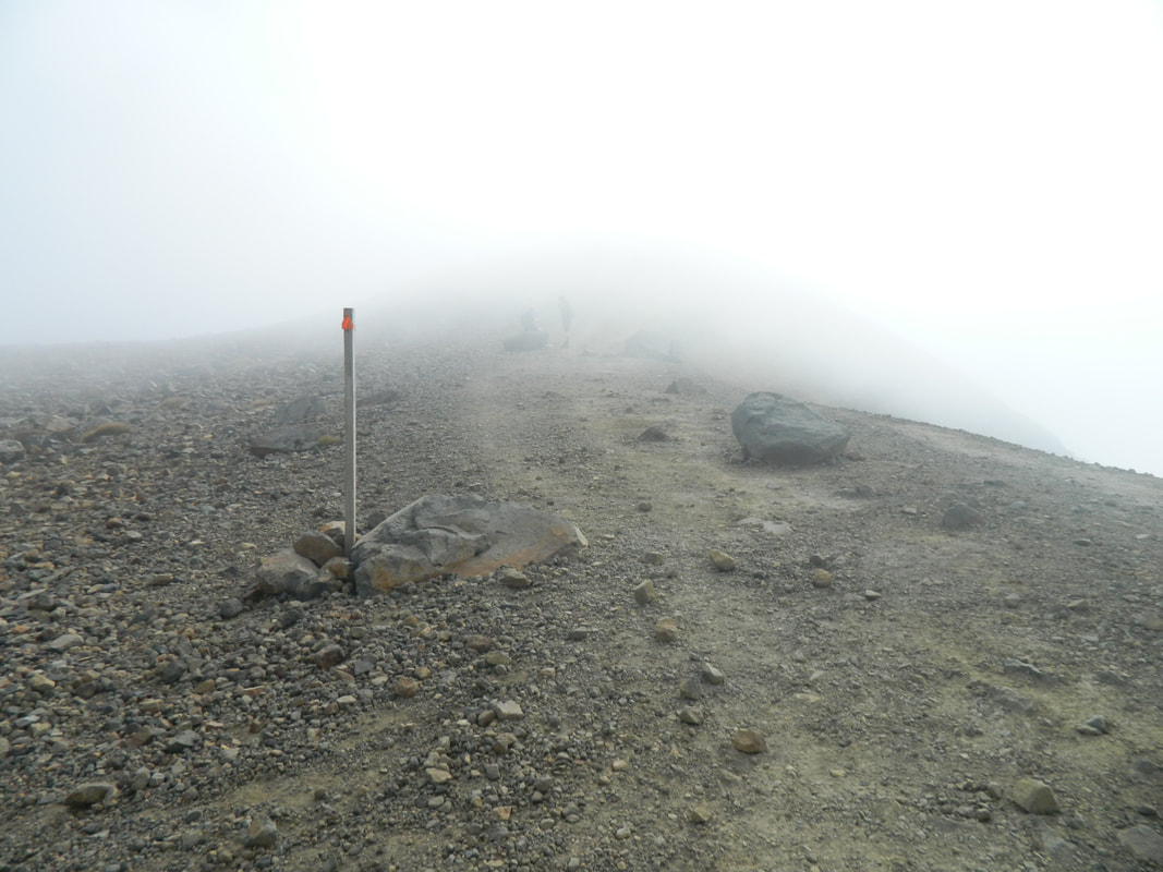
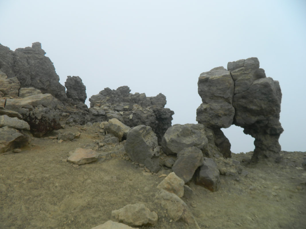
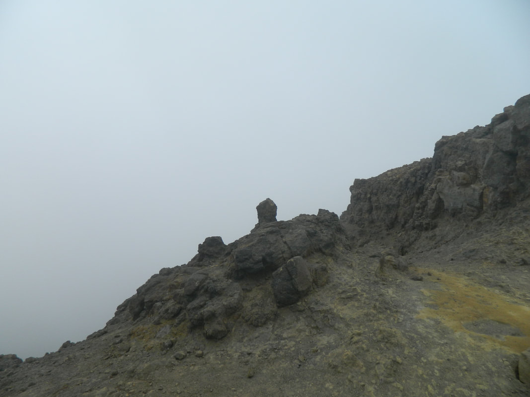
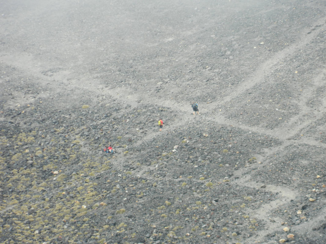
The south crater makes you feel like you're on Mars! The clouds were really low when we were making our way across, so it made it look more eerie but it was such a cool experience and made for fantastic photos.
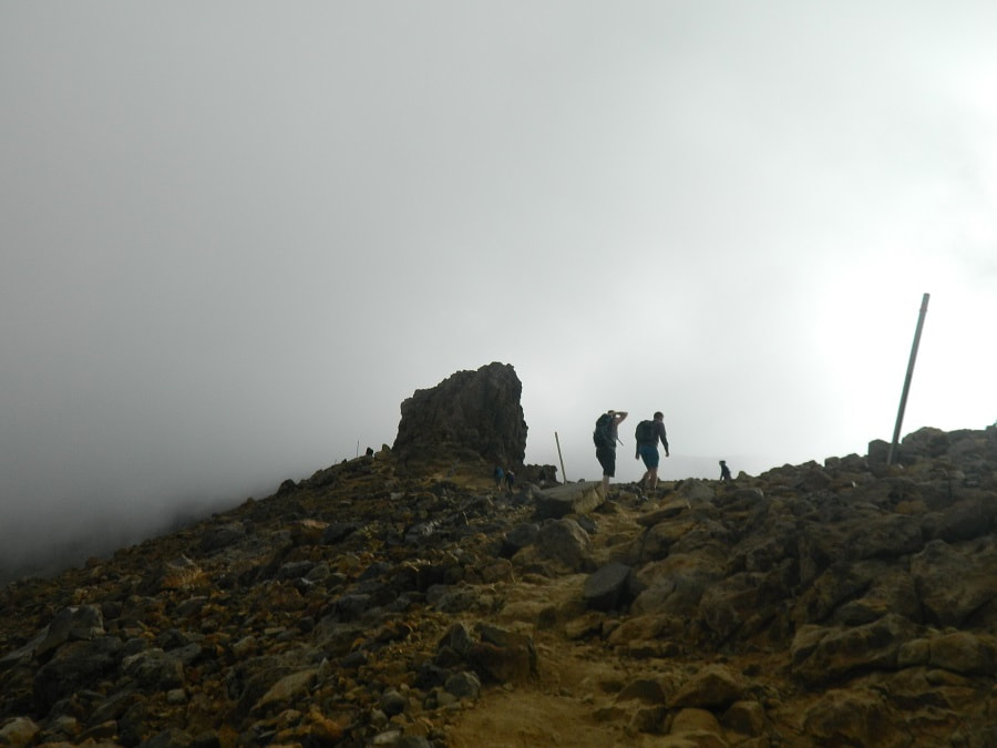
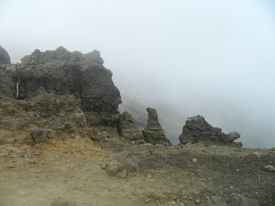
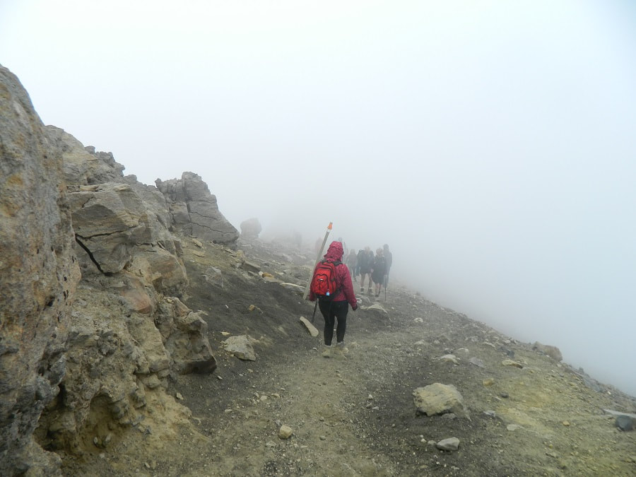
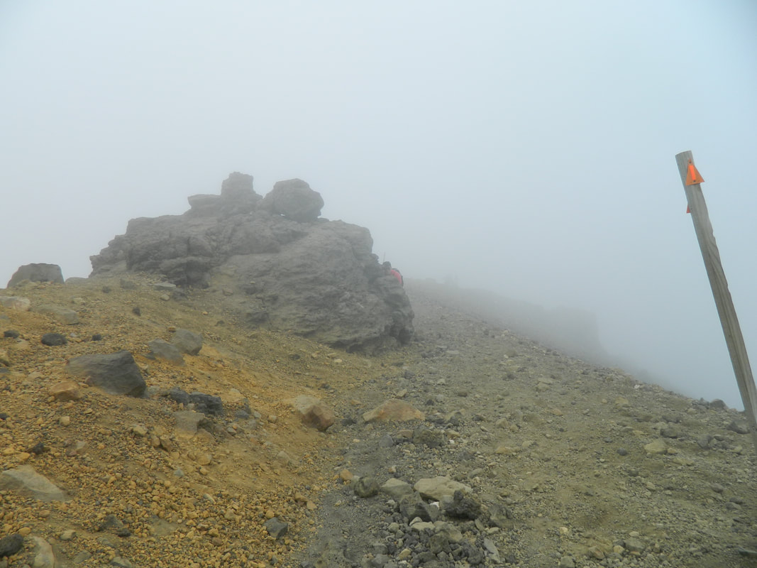
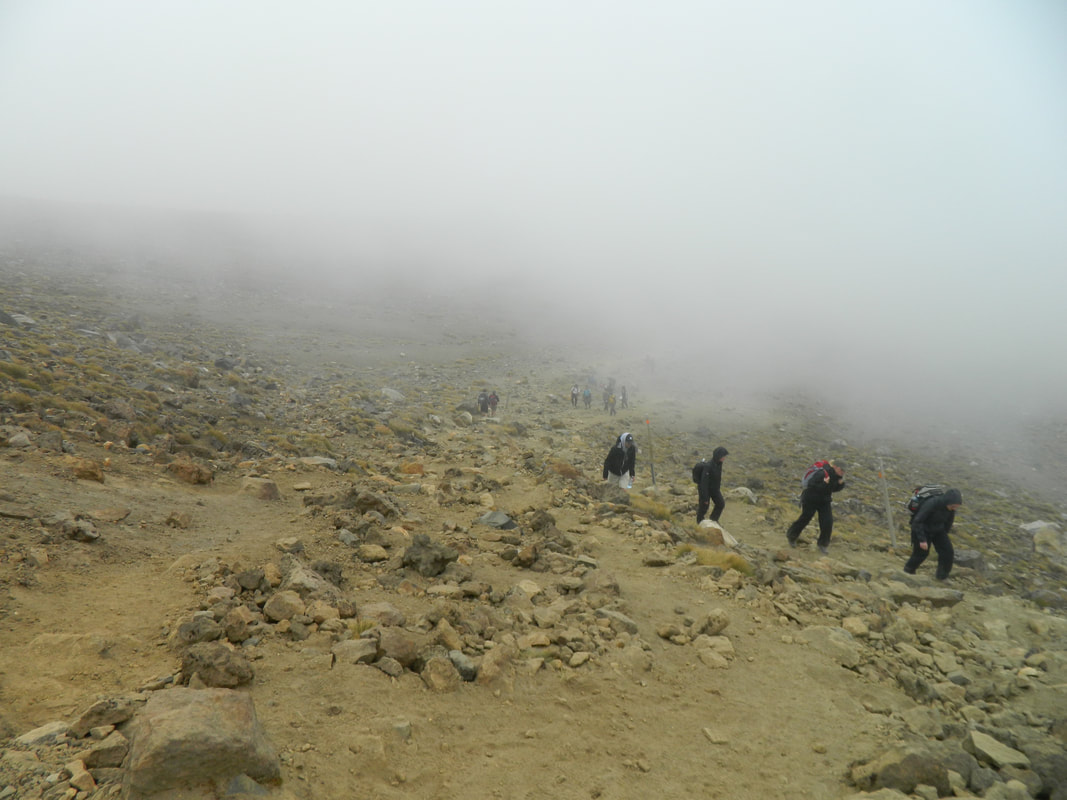
When we got through the south crafter, we headed up and up and up again. This is where the clouds started to thicken and the wind really got up. It felt like it was gusting at 100kms! We had to hold onto some boulders at some points and our clothes felt like their were going to rip off us, the wind was that strong! It just goes to show how extreme the weather can be up the mountain and why it's so important to be prepared for all weather - including snow, in the middle of summer. We didn't see much at all from here as the clouds were so thick and sometimes we could barely see 2 meters ahead of us.
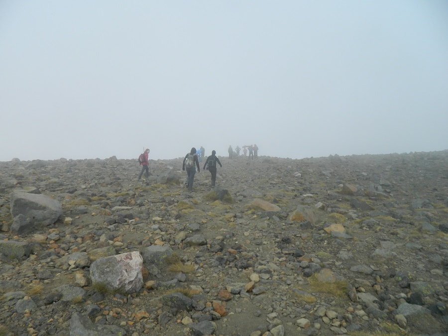
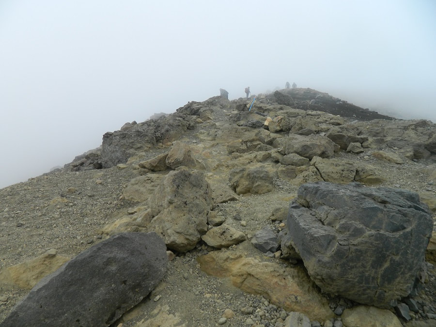
We made our way up some scree, which was hard with the wind and I found it challenging as I absolutely hate heights and it looked like it was a sheer drop on either side of the track so it wasn't too fun! At the top of this part you get amazing views of the Emerald Lakes, but it just wasn't going to happen for us with the weather!
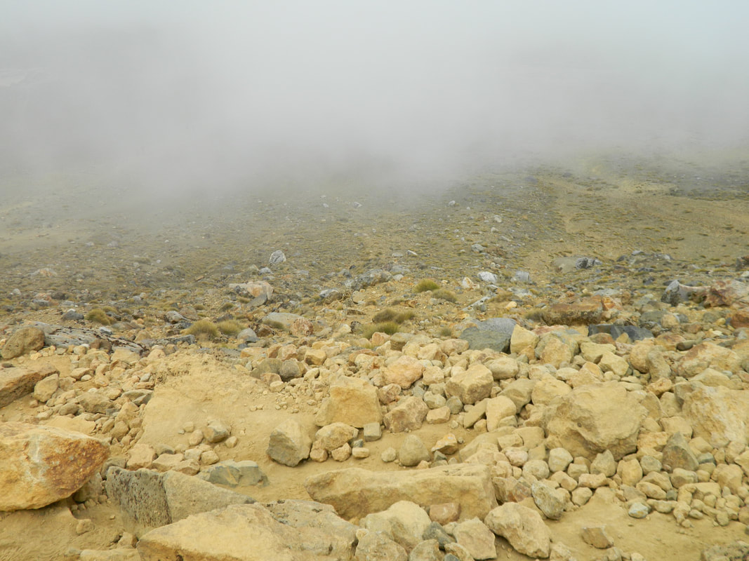
We had to turn back at this point and make our way back down because of the track closure. However, when the track is open and hopefully the weather is good, you'll get incredible view of the Emerald Lakes as well as views of the Kaimanawa Ranges and the Oturere Valley. You might even see some steam vents and get a whiff of some rotten eggs aka the sulphur in the vents.
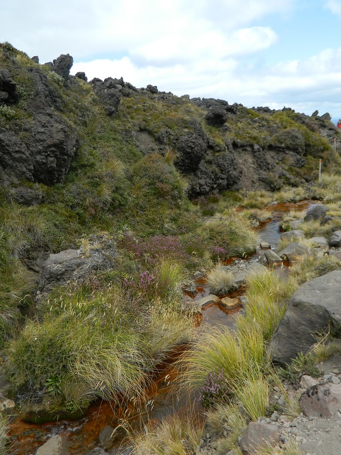
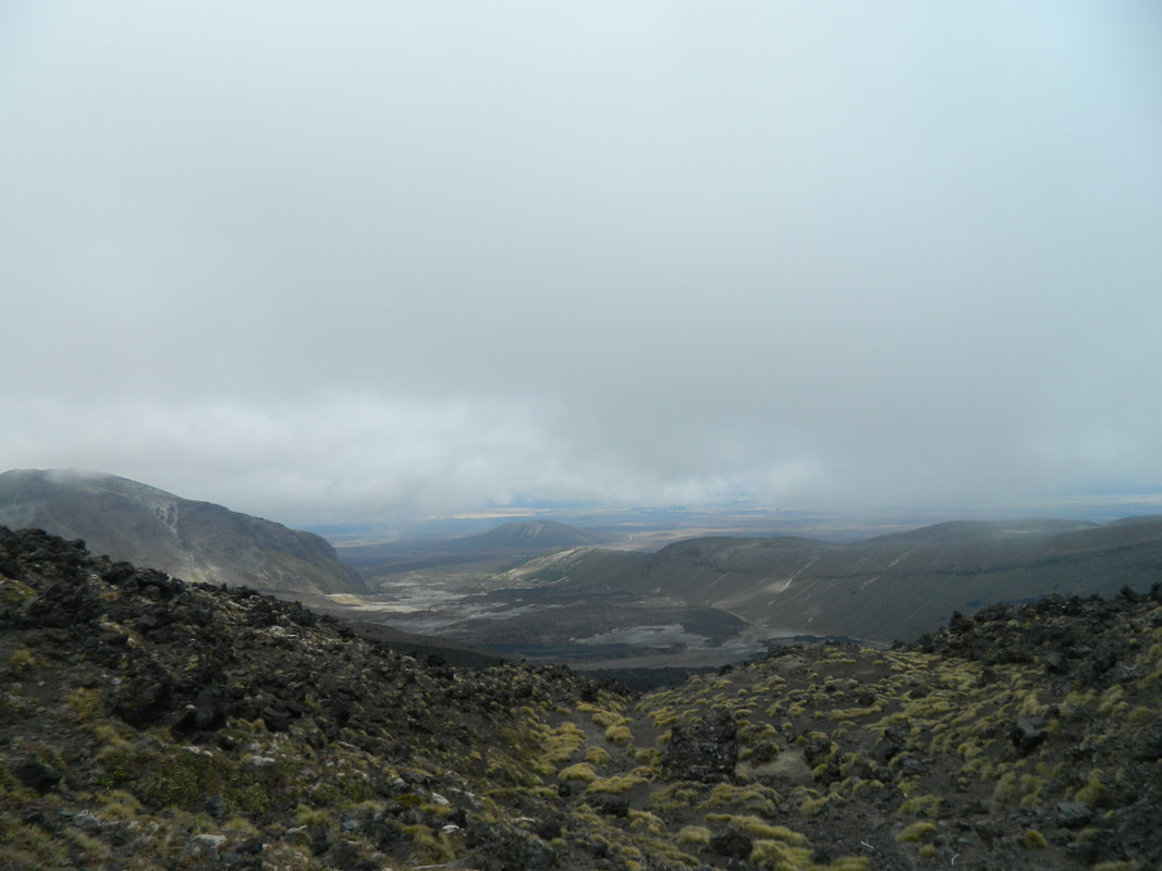
The next part of the track takes you around the central crater, up to the Blue Lake, across to the north crater and down to the Ketetehair shelter. On the way down you have great views of Lake Taupo and Mt Pihanga on clear days.
From the shelter, you will follow a track that takes you alongside the Mangatetipua Stream, past a waterfall and shortly after you will reach the Ketetahi carpark where you'll no doubt curl up into a ball and cry for your mammy and wish for the bus to arrive. No? Just me?
We left at 6am which was hard to wake up to, get on a bus and start a 7-hour hike! However, this is necessary because of the daylight hours - you don't want to be walking back in the dark.
The first part of the track is a flat boardwalk that takes you through a valley, tricking you into thinking the whole walk is like this! Cheeky! You are dwarfed by mountains as you make your way along beside the Mangatepepo Stream and flat areas with rocks and grasses. If the weather is bad in the valley, it's advised to turn back as the weather will get worse the higher up the mountain you go.
When the flat part of the track ends, you know you've made it to the Devil's Staircase - 2 hours of thigh-burning, ankle-killing stairs! With every step, you just have to think about how amazingly toned your calves and thighs will be afterwards. The staircase takes you up over 1400 meters above sea level and offers some pretty sweet views of the valley below. Once the stairs stop, you still trek upwards, through ancient lava flows and around big boulders.
The south crater makes you feel like you're on Mars! The clouds were really low when we were making our way across, so it made it look more eerie but it was such a cool experience and made for fantastic photos.
When we got through the south crafter, we headed up and up and up again. This is where the clouds started to thicken and the wind really got up. It felt like it was gusting at 100kms! We had to hold onto some boulders at some points and our clothes felt like their were going to rip off us, the wind was that strong! It just goes to show how extreme the weather can be up the mountain and why it's so important to be prepared for all weather - including snow, in the middle of summer. We didn't see much at all from here as the clouds were so thick and sometimes we could barely see 2 meters ahead of us.
We made our way up some scree, which was hard with the wind and I found it challenging as I absolutely hate heights and it looked like it was a sheer drop on either side of the track so it wasn't too fun! At the top of this part you get amazing views of the Emerald Lakes, but it just wasn't going to happen for us with the weather!
We had to turn back at this point and make our way back down because of the track closure. However, when the track is open and hopefully the weather is good, you'll get incredible view of the Emerald Lakes as well as views of the Kaimanawa Ranges and the Oturere Valley. You might even see some steam vents and get a whiff of some rotten eggs aka the sulphur in the vents.
The next part of the track takes you around the central crater, up to the Blue Lake, across to the north crater and down to the Ketetehair shelter. On the way down you have great views of Lake Taupo and Mt Pihanga on clear days.
From the shelter, you will follow a track that takes you alongside the Mangatetipua Stream, past a waterfall and shortly after you will reach the Ketetahi carpark where you'll no doubt curl up into a ball and cry for your mammy and wish for the bus to arrive. No? Just me?
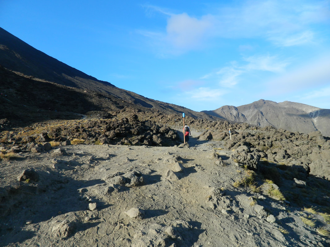
Lath heading up the track
The views were out of this world
At this point, we felt like we were all heading towards some alien spaceship
Potential Hazards
There is always volcanic risk on the Tongariro Crossing - you're surrounded by mountains, mostly dormant but there is still activity happening. There are monitoring systems that monitor the activity, but volcanoes can be unpredictable so hiking the crossing is 100% at your risk. The volcanic risks can be found here on the DOC website and on GeoNet.
The red crater, Ngaruruhoe and Te Maari vents have all had some sort of activity going on within the last 100 years and we experienced this with Te Maari when we did the crossing in 2012.
The weather can turn at any point - it's not uncommon for it to snow in summer and the hazards in winter are even more severe, with risks of avalanches. DOC have any weather warnings on their website which pays to check before you go, click here.
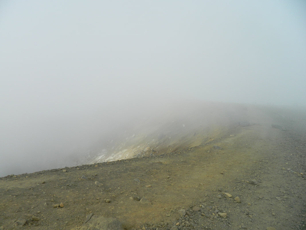
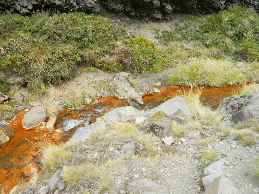
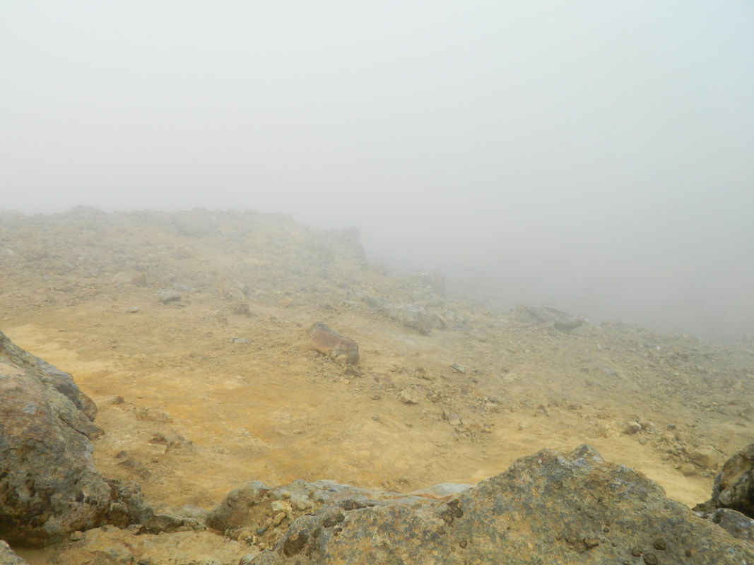
There are steam vents near the Emerald Lakes and you do not want to go near them at all, you can get severe burns!
The red crater, Ngaruruhoe and Te Maari vents have all had some sort of activity going on within the last 100 years and we experienced this with Te Maari when we did the crossing in 2012.
The weather can turn at any point - it's not uncommon for it to snow in summer and the hazards in winter are even more severe, with risks of avalanches. DOC have any weather warnings on their website which pays to check before you go, click here.
There are steam vents near the Emerald Lakes and you do not want to go near them at all, you can get severe burns!
The track was super cloudy on the way up
This is the point where the winds started and it got vuuuuuuury cold
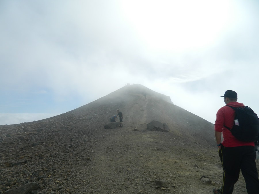
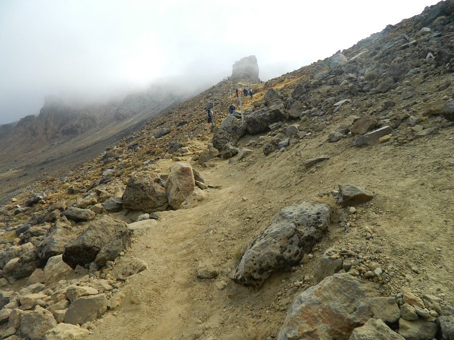
One last slog before we get to the top!
The Best Time To Go
Between November to May is the best time to do the track but it can be super-hot and there is no shade at all along the way, so you need to be prepared for the heat and the potential for it to turn to subzero temperatures in a flash! We did it in December and couldn't believe the amount of people that went up in shorts and a thin jumper, carrying one small water bottle - that was it... no backpack or warm jackets in case of any weather change, we couldn't believe it!
It can even start pouring down, so it would be absolutely miserable if you were on the crossing with no raincoat or spare clothes and still have 5 hours to go - brrrrr!
The Tongariro Crossing is where most of the people are rescued on hikes in New Zealand.
It can even start pouring down, so it would be absolutely miserable if you were on the crossing with no raincoat or spare clothes and still have 5 hours to go - brrrrr!
The Tongariro Crossing is where most of the people are rescued on hikes in New Zealand.
Some parts of the track are steep, so good footwear is needed
Everyone was bracing themselves against the strong winds
The fog made for great photography
Heading into the unknown
Get Ya Snow On
Between June and October, it's a lot more challenging due to the snow and ice, freezing temperatures and avalanche risks, so you will need to have experience with this terrain in ice and snow and it's recommended to hike with a guide.
We think it would be pretty spectacular hiking in the snow... we can practice in winter on the Hooker Valley Track to get some snow hiking experience first!
The NIWA website is good place to check for weather hazards, especially in winter - check it out here.
We think it would be pretty spectacular hiking in the snow... we can practice in winter on the Hooker Valley Track to get some snow hiking experience first!
The NIWA website is good place to check for weather hazards, especially in winter - check it out here.
Humans returning from the spaceship
The landscape was bare but beautiful
It was a long day but it's so worth doing
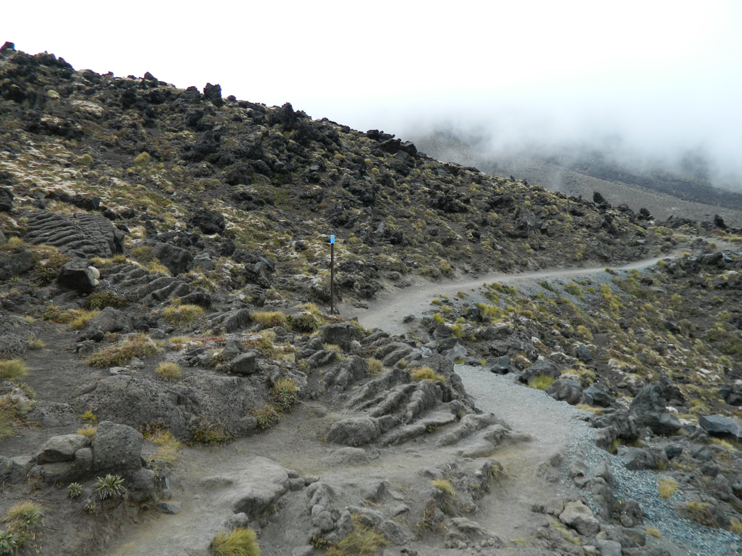
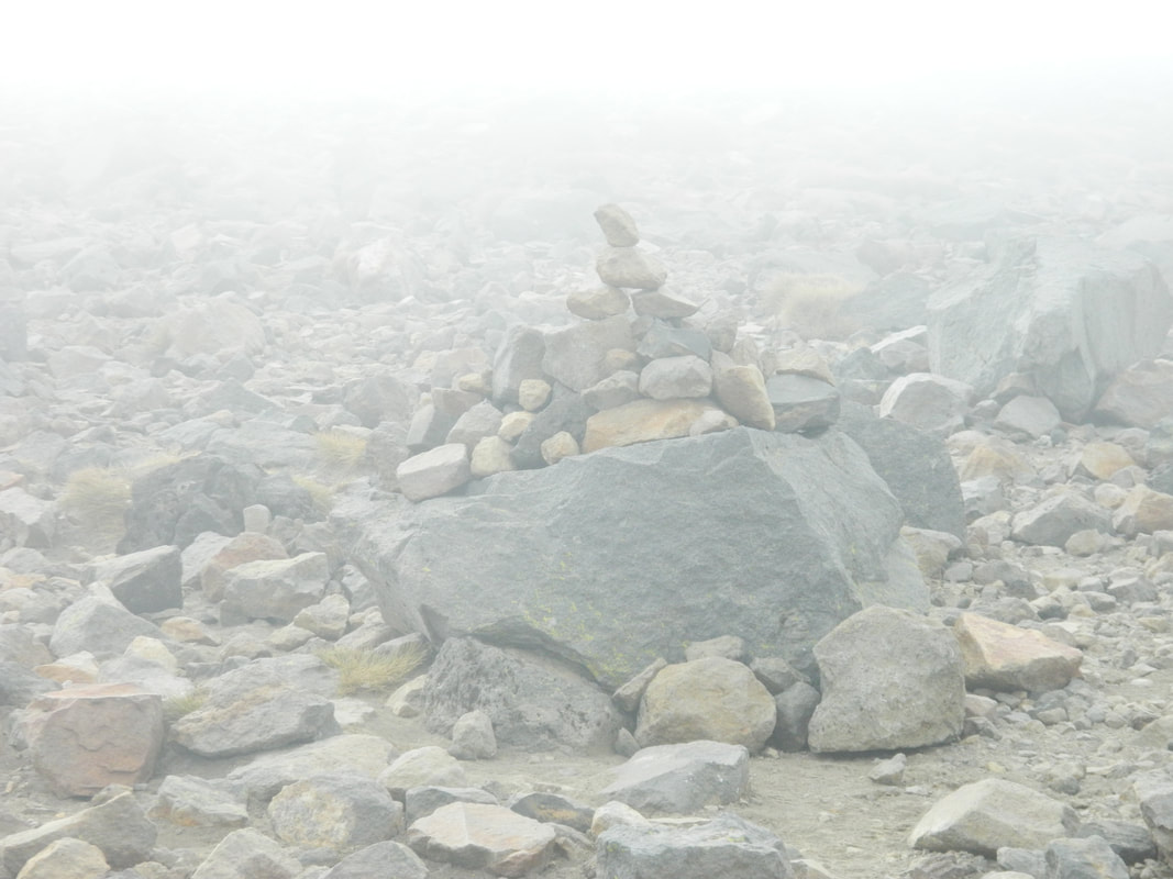
There are markers on the track to help you find your way in the snow
Then The Sun Came Out!
When there are no clouds covering the mountains, you get the most amazing views across the country! It would have been great if we had no clouds on the way up, but it was still a magical hike and it made the day more unique.
We were really hot heading back down but we had no shorts to change into because when we were leaving Auckland, someone left the boot open on our station wagon so of course the MAIN thing we needed (our backpack) only went and rolled out of the car when we were going up a hill! We had no idea until we got to our campsite at Whakapapa.
It was our Camelbak, which is our go to backpack for hiking, and it had our shorts, thermals, jackets, gloves and beanies! We ended up going into Turangi, late at night, seeing if we could find anyone selling a backpack and warm clothes. We asked locals we passed in the street to see if they had a backpack we could buy off them - we got some weird looks!! The only thing I managed to find was a hat at the gas station so we had to cram everything into our one and only backpack, including a massive, thick jumper that pretty much took up the whole bag!
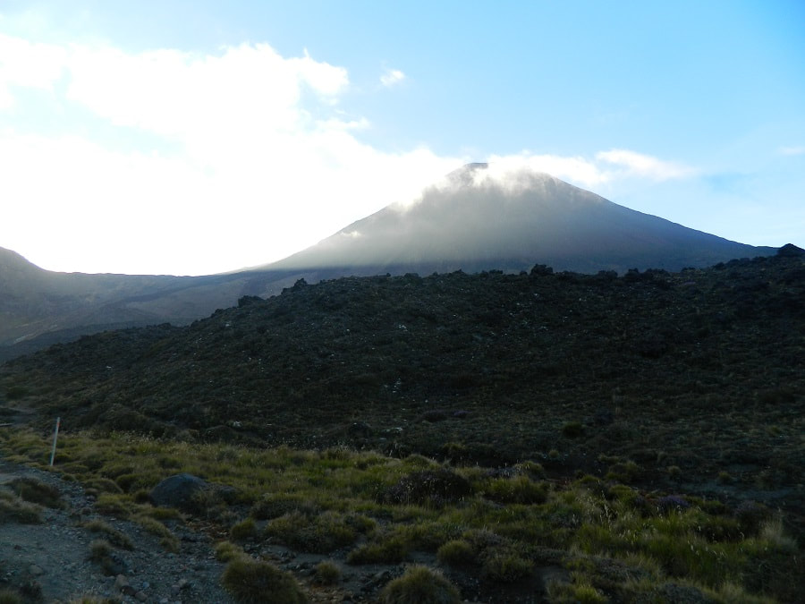
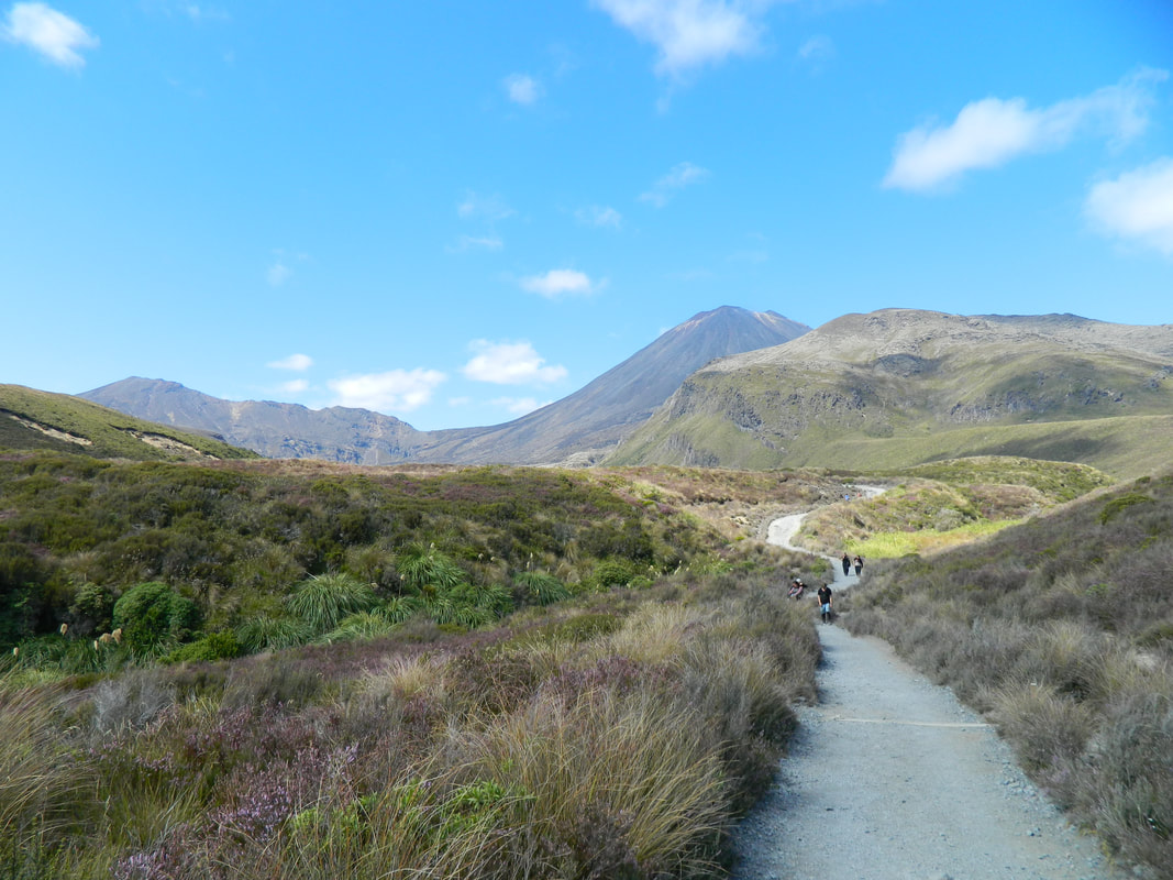
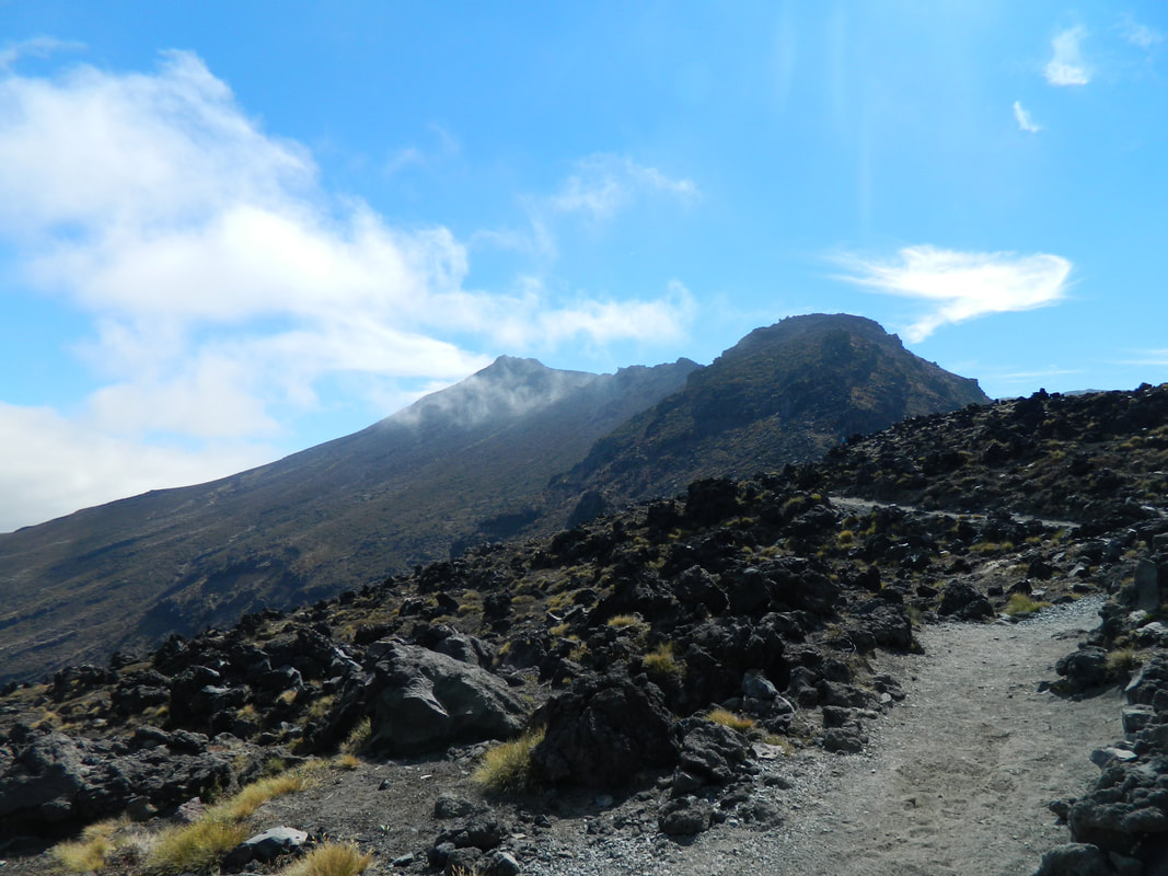
Mt Ngauruhoe
The fallen scree on the mountainside looks similar to the one we saw on the Hooker Valley Track in the South Island
The track was fairly busy, but we didn't feel like anyone got in our way
Oh yeah, NOW the sun comes out when we're almost back to the start of the track!
The view from the carpark ain't all that bad!
Know Before You Go
- Dogs aren't allowed on this trail
- There is no shelter on the walk
- There are toilets every 1 - 2 hours on the trail but you'll need to bring your own loo paper
- Take plenty of water
- On labour weekend in October until April 30th, there is a 4-hour max parking restriction at the end roads, so it's best to book a shuttle!
- The track is one way, you will need to book transport from the other end
- Allow 7 - 9 hours for this hike
- Don't go near any steam vents as you can get severe burns
- In winter there are risks for avalanches and there can be a lot of ice and snow
- It can snow all year round
- There are always volcanic risks
- Take a raincoat, spare clothes, thermals, sunhat, warm jacket and pants, gloves, plenty of water, toilet paper, food and a camera! If you're going more in winter, you will need more serious and warmer gear to get you through the hike
- Let someone know that you're going on the hike and when you plan to be back
Mappy McMap Face
Getting There
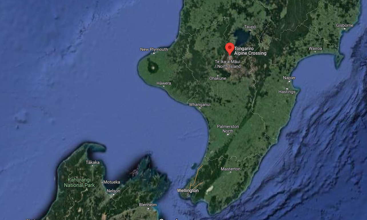
The Tongariro Alpine Crossing is just 3 hours 45 minutes south of Auckland City and 3 hours and 50 minutes north of Wellington City and is situated in the Tongariro National Park in central North Island.
It's recommended you take a shuttle to the start of the hike as there is a 4-hour limit for parking and you are definitely going to be longer than that PLUS it's a one-way track kinda deal, so you need to be picked up on the oooother side. There are local shuttles who can pick you up from your accommodation and most accommodation providers will have their own shuttle service, so just ask.
It's recommended you take a shuttle to the start of the hike as there is a 4-hour limit for parking and you are definitely going to be longer than that PLUS it's a one-way track kinda deal, so you need to be picked up on the oooother side. There are local shuttles who can pick you up from your accommodation and most accommodation providers will have their own shuttle service, so just ask.
Conclusion
The Tongariro Crossing is a New Zealand treasure. It's a hike filled with many incredible views, ever changing landscape, blue and emerald lakes and of course the thrill of knowing you're on or right next to a volcano is pretty epic. The views will definitely leave you speechless and often make you feel like you're on another planet! It's a full day hike that is totally worth doing with the family (if the kids are up for a 7-hour hike!).
Gallery of the Tongariro Crossing
Check out the rest of the awesomeness that didn't make it to the main blog but deserves to be shown.
More North Island adventures
SMUGGLERS BAY LOOP TRACK
NORTHLAND If you want to go to paradise, this is the place! Emerald water, clear rock pools and octopus encounters await you.
|
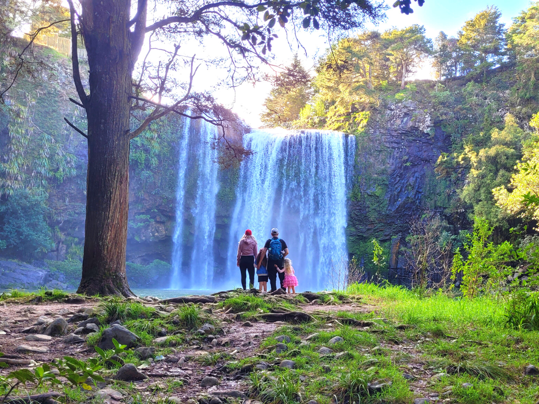
WHANGAREI FALLS
NORTHLAND A powerful 23.6m high waterfall along the Hatea River in central Whangarei. These falls will blow your mind. Remember your raincoat! |
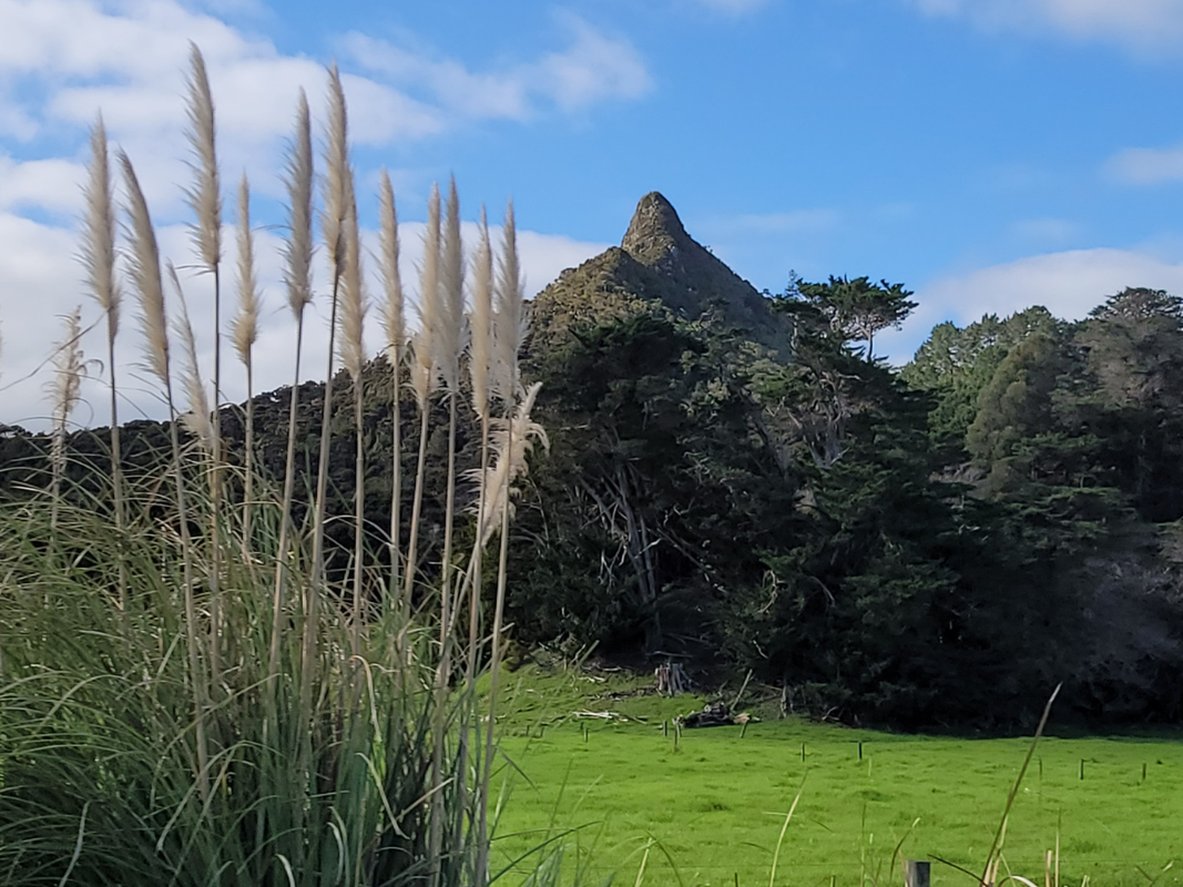
TOKATOKA PEAK
NORTHLAND A very steep 20-minute track that rewards you with 360 deg views of the Wairoa River and the Northland countryside. |
SEND US A MESSAGE, WE LOVE GETTING MAIL! |
DISCOVER |
FOLLOW US
BORING (BUT IMPORTANT LEGAL) STUFF |
